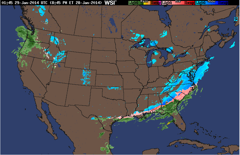
For some across the United States the weather was a little peculiar. Snow and sleet hit the deep south for the first time this winter, which I'm sure sent the southerners scampering for shovels and ice picks.
The surface analysis shows much of the U.S. enjoying the sunny skies of a high pressure system. The low pressure system can be seen across the majority of the south shrouded in precipitation and cold temperatures.
the Windcast shows freezing air from Canada blasting through Minnesota on its way through the upper midwest. While most of the U.S. had winds swirling from the south and west.
Tomorrows Forecast shows a high pressure system moving out the storms the South saw today, melting the slight dusting they experience only once in a blue moon. Wisconsin should be mostly clear with temperatures finally breaking 0 degrees. A low pressure system seems to be moving eastward from Canada and will probably cause snow in the near future.


No comments:
Post a Comment