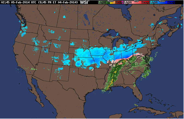
The current national radar shows a large storm system over much of the central U.S. In the south over Mississippi and Alabama lies a large storm system which looks like it contains several large thunderstorms. Where temperatures allow it, the large system turns into snow covering most of Ohio all the way through Kansas and Nebraska.

Current surface analysis shows the storms following a large low pressure system that is immediately chasing away higher pressurized areas away in the northeast. Out west, another cold front seems to be passing through over the rockies.

The wind chill across the U.S. shows bitter cold reaching down from Canada once again. After a series of warmer winters, this one seems to have righted the ship, with temperatures reaching below zero becoming the norm for much of the northern states across the mid- and mountain west.

The jet stream shows more of the U.S. being affected by westerly winds compared to yesterday's that were dipping all the way down to Mexico before making a turn north. The fastest winds seem to be at the forefront of the large storm system moving through the heart of the U.S.
No comments:
Post a Comment